Severe Weather Alert: Multi-Day Storm Threat Hits Central and Eastern US
2 min read
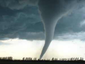
Monday Severe Outlook (Photo By FOX Weather)
Missouri (The Lake Tribune) – As April begins, a significant severe weather threat looms over the central and eastern United States, signaling the start of the most active tornado season. From Monday through Tuesday, tens of millions of Americans are braced for a series of severe storms capable of producing large hail, wind damage, and tornadoes. This widespread severe weather event is anticipated to affect areas from the southern Plains northeastward into the mid-Mississippi and lower Ohio valleys, extending into the mid-Atlantic and central Gulf Coast states by Tuesday.
The storm system responsible for recent flooding rainfall in Southern California is forecasted to initiate a new area of low pressure in the central Plains early this week. “This powerful low, spurred by a significant dip in the jet stream, is expected to develop in Texas on Monday and will track northeast,” explained FOX Weather Meteorologist Kendall Smith.
As moisture from the Gulf of Mexico flows northward, atmospheric conditions over the southern Plains and mid-Mississippi Valley will rapidly destabilize by Monday afternoon, heightening the severe weather risk.
Impact and Precautions
The immediate threat zone for Monday spans across an area home to over 45 million people, encompassing major cities such as Dallas, Texas; Oklahoma City, Oklahoma; St. Louis, Missouri; Indianapolis, Indiana; and Cincinnati, Ohio. This region faces the potential for very large hail, particularly across the southern Plains and Ozarks, where hail could reach the size of baseballs. “The scale of this threat necessitates early precautions to protect lives and property,” Smith emphasized.
Southern Missouri into southern Illinois is marked as having the greatest tornado risk by Monday evening. Additionally, severe thunderstorms with the potential for nighttime tornadoes are forecasted for the lower Ohio Valley. Given that nighttime tornadoes are significantly more deadly than daytime occurrences, residents are urged to have reliable means of receiving weather alerts during the night.
Safety Measures
Residents in the affected regions should:
- Monitor local weather updates and heed warnings from officials.
- Prepare a safe shelter area, free from windows and external walls, in case of tornadoes.
- Secure or move indoors any loose outdoor items that could become projectiles.
- Review emergency plans with family members, ensuring everyone knows what to do and where to go.
- Ensure mobile devices are charged and capable of receiving emergency alerts through the night.
This severe weather event serves as a reminder of nature’s power and the importance of preparedness during the peak tornado season. Stay informed, stay safe, and take the necessary steps to protect yourself and your loved ones.
Follow The Lake Tribune in NewsBreak for More Reliable News in Your Feed